How familiar are you with the states of Mexico? The world’s most populous Spanish-speaking country can at times be overshadowed by the 50 states of its northern neighbor. Show the 31 Mexican estados with a 3-D geographic display.
1.
Divide into teams to research the 31 (plus one Federal District) Mexican states. Research the history and resources that makes each state unique. Choose visual symbols that tell the state’s story. For example, Yucatan has the famous Mayan ruin of Chichen Itza, one of the new Seven Wonders of the World. The state of Quintana Roo contains many internationally renowned beach resorts.
2.
As a class, determine the scale to be used for a large-scale relief map. Each state must conform to this agreed-upon system of measurement so all state borders fit together to form the country.
3.
For each state, roll out a Crayola® Model Magic® slab for the base. Place these bases on cardboard large enough to hold the entire country of Mexico. Make sure the edges fit properly.
4.
Add each state’s terrain elements and sculpt the dimensional elements (mountains, rivers) with more modeling material to make a 3-D relief map. Use Crayola Scissors to cut shapes from Model Magic compound.
5.
Use Crayola® Squeezables™ 3-D Paints to label each state and to intensify textural aspects of the relief. Air-dry the map for 3 days.
6.
Student teams describe their maps and findings to the class.
Dig deep into an ancient Mexican culture! Recreate colors reminiscent of traditional turquoise and coral found on these
Explore growth cycles through the seasons then create original chalk drawings of pumpkins ready for harvest.
Why do countries celebrate their independence days with fireworks? Why do people hang national flags on patriotic holida
What would you do if you were a national leader? Imagine yourself as the head of a government, and draw your dreams for
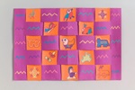
Paper weaving and crayon designs add color to your Mexican culture classroom celebration.
The canals and gardens of Xochimilco, Mexico, are filled with history and environmental interest for tourists and reside
How are elections held? What do government leaders do? Begin with a briefcase that opens up new branches of learning.
Explore the native Huichol social-cultural system and create replicas of beaded Huichol masks.