Classmates collaborate to illustrate—and then present a mock talk show—about a country’s land formations and features. Prepare bright neon topographical maps and a riveting script!
1.
<STRONG>Choose a country.</STRONG> What can you learn about a country from a relief or topographical map? How have natural forces and humans shaped the landscape? With a partner, create a topographical map of a country of your choice. Find where towns and cities are located among mountain ranges, on plateaus or plains, or on lowlands near water. Discover more about the country’s location and physical characteristics as you prepare to report your findings in a talk-show format.
2.
<STRONG>Make a topographical map</STRONG>. Using Crayola Erasable Colored Pencils, outline a large map of the country on paper. Indicate neighboring countries or bodies of water if you wish. With Crayola Glue Sticks, attach the map to cardboard. To show oceans, lakes, and rivers, fill those areas with blue neon Crayola Model Magic®.
3.
Choose more neon colors to represent other land elevations. Add lowlands to your relief map. For plateaus and mountains, add extra layers of Model Magic to build height, changing colors according to the elevation. Pinch up mountains to their relative height.
4.
<STRONG>Label the features.</STRONG> Draw small paper flags, cut them out with Crayola Scissors, and color them. Erase the name or other information you want on the flag. Leave your erased areas white or fill with contrasting colors. Outline words if you wish. Use Crayola School Glue to attach flags to toothpicks. Air-dry the glue. Place flags into the Model Magic in their correct positions. Add a color key.
5.
<STRONG>Do your broadcast.</STRONG> With your partner, write a talk-show script to tell your classmates what you learned about the country’s terrain and geography. Present it to the class in a compelling way to spark more interest in the country.
Explore the rich visual culture of ancient Egypt! Create a captivating multimedia portrait in historic Egyptian style.
A famous section of Beijing, the capital of China, is surrounded by a moat. Imagine being in The Forbidden City, where a
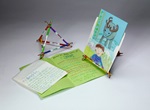
Explore Prince Edward Island with Anne of Green Gables! Draw and describe this enchanting Canadian island in an accordio
How do pets or wildlife care for their young? Discover how young animals change as they grow!
What pets do you feed, walk, or groom? Izak, who lives in Lapland, takes care of a reindeer! Match animals with owners a
Does animal brain size match body size? Affect intelligence? Sculpt the brains of three vertebrates to compare and contr
Students go wild filling Beasty Books and their brains with fun facts and figures about their favorite creatures.
Looking for a pizzazzy book report format? Try bas-relief sculpture to add a new dimension to your next presentation!